Latest News
Back
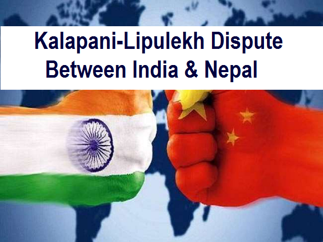
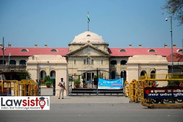
Mapping the history of Kalapani- Lipulekh dispute between India and Nepal
Neighbors India and Nepal, sharing an open border, have not always had the most cooperative relationships, oscillating from one extreme to another. One of their longstanding conflicts has been over the Kalapani border region. This discord has the potential to disrupt other aspects of their relations, especially in the economic realms and cross-border security. If the two countries fail to resolve the conflict, it could provide an incentive to intervene with other stakeholders such as China (the one who is looking for a chance to fight). This Article is to mapping the history behind the dispute between India-Nepal. The dispute itself goes back to the early 19th century when the British controlled India and Nepal under the reign of King Prithvi Narayan Shah was a conglomeration of small kingdoms.
The issue is currently in the daily press, since, Nepal published a new, authoritative political map on 20th of May showing the regions of Lipulekh, Kalapani and Limpiyadhura as part of its territory, strengthening its position on a recent territorial dispute with India.
The decision by the Nepali government to announce a new political map came after India published its map more than six months ago, including in its claimed territories the Lipulekh and Kalapani regions. Tensions between the two neighbors deepened further as India, as part of the Kailash-Mansarovar pilgrimage route, inaugurated a road linking Dharchula in Uttarakhand state with Lipulekh.
This fight over a geographic territory's historical accuracy is one that has been boiling for several decades between the two neighboring countries. The major point of contention is the trijunction between Nepal-India and China (Tibet), between Kalapani-Limpiadhura-Lipulekh located at the heart of the Kali River at an altitude of 3600 meters, the Kalapani territory situated on the eastern border of Uttarakhand in India and Sudurpashchim Pradesh in the west of Nepal. India claims that the area is part of the Pithoragarh district of Uttarakhand while Nepal believes that it is part of its Dharchula district. Matters came to a boil earlier this year, when India opened an 80-kilometer road between Uttarakhand and Lipulekh, across the disputed piece of land.
Why Nepal is objecting to Kailash Mansarovar's road connecting via Lipulekh Pass?
Earlier this year, when Defense Minister Rajnath Singh inaugurated the road route which will make the trip more comfortable and less expensive to visit Uttarakhand to the holy abode of Lord Shiva Kailash Mansarovar, a pilgrimage site nestled in the Himalayas in Tibet that almost goes up to the Lipulekh Pass at the border between India and China — 17,000 feet above sea level. The new route via Uttarakhand will have three main stretches: The first one is a 107.6 km long road from Pithoragarh to Tawaghat, the second will be from Tawaghat to Ghatiabgarh on a 19.5 km single lane, and the third is the 80 km from Ghatiabgarh to Lipulekh Pass at the China border.
The Border Roads Organisation (BRO) is turning the second stretch into a double lane road and has constructed a new road on the third stretch to accommodate vehicles. This has completed 76 km of the 80-km stretch so far, cutting travel time to only two days by a vehicle.
The new route, a light vehicle will travel up to 75 kilometers (5 kilometers from the boundary) and a five-day hike would be reduced to two days on the road, saving six days on and off the road. Compared with other roads, the latest route is the shortest, just one-fifth of the distance of road travel. Most of the road in the new route will be on the Indian side as well. There is no air travel involved and the entire route is in cars, except for a 5 km trek across the Lipulekh Pass on the China side.
Nepal, however, contends that the Lipulekh pass comes within its territory and lies in Sudurpashchim Pradesh's Dharchula district. It is marked by the Kalapani river, one of the headwaters of the Himalayan Kali River at an altitude of 3,600–5,200 meters.
India has always considered Lipulekh as a tri-junction, with Nepalese territory to the east of the pass.
In this area, the Kali River forms the boundary between India and Nepal. The river headwaters aren't included in the boundary, according to India.
However, Lipulekh has always been on the Indian map and so far Nepal has not protested. China also accepts that it belongs to India, which is why it allows it as a route towards Tibet.
Owing to the Sino-Indian War of 1962, India had closed Lipulekh from 1962 to 1991. The local men, Kumaon's Byansis, then used the Tinkar Pass for all of their trade with Tibet.
Neighboring India and Nepal, the dispute over the historicity of mapping data, which both sides said to be the most accurate, complicates the matter. The problem itself goes back to the early 19th century when the British controlled India and Nepal.
The India-Nepal-British relations
Prithvi Narayan Shah is believed to be the most ambitious ruler among the Gorkhas, under whose rule Nepal was unified in the late 18th century, its domains extending as far as Sikkim in the East and Uttarakhand in the Garhwal and Kumaon in the West.
By the early 19th century, as the English East India Company EIC began to expand its territories in Awadh northward, it came close to Palpa, an independent city within the heartlands of Nepal. A border dispute arose between both powers soon after. The Nepalese have also proved to be an obstacle in enabling the British to realize their ambitions with Tibet.
The British finally declared war on Nepal on 1 November 1814. Over the next two years, the fighting proceeded, including a number of campaigns. Sir David Ochterlony, a British general, managed to evict the Nepalese from Garhwal and Kumaon in 1815.
The war ended a year later with the signing of the Sugauli Treaty. As it stands today, the Treaty delimited the boundaries of Nepal.
As Whelpton stated, the treaty "required Nepal to surrender all territories west and east of its current boundaries, surrender the entire Tarai and recognize a permanent British representative (or 'resident') at Kathmandu."
Hence, the Kali River marked Nepal 's western boundary. There is, however, no clear consensus as to what the precise location of the Kali River is, giving rise to the dispute as to whether the Kalapani-Limpiadhura-Lipulekh land is part of India or Nepal today.
The border problem has come up on numerous occasions over the last few decades, and despite repeated negotiations, the two countries have struggled to find a consensus.